SOMA BAY GUIDE / MAPS
The Coastal Atlas.
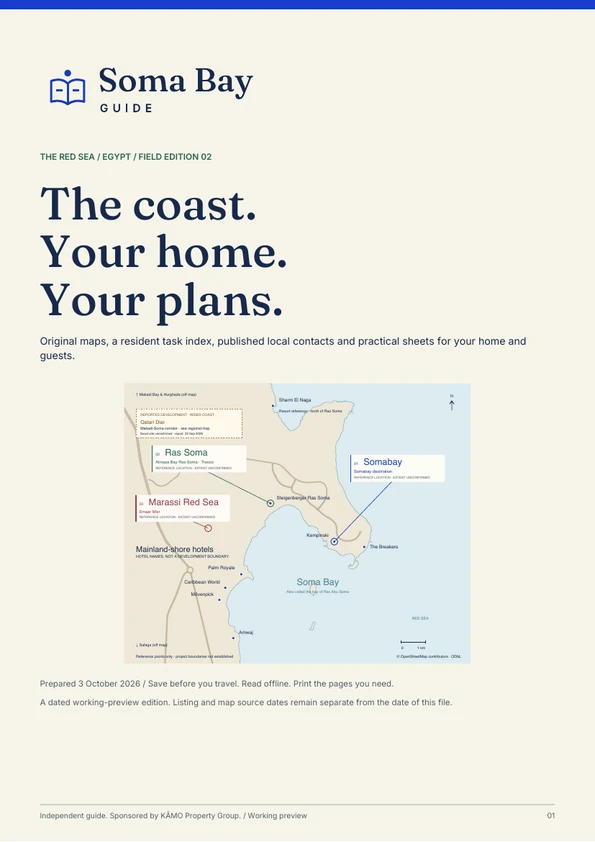
Understand the coast at three scales: the wider region, the places around the bay, and the plans over the real ground.
Pins locate places, not entrances or property boundaries. Map sources & limits · © OpenStreetMap contributors
Explore the coast.
Choose a place, compare its position and zoom between the wider coast and the bay.
Open the interactive atlas ↗02 / ZOOM OUT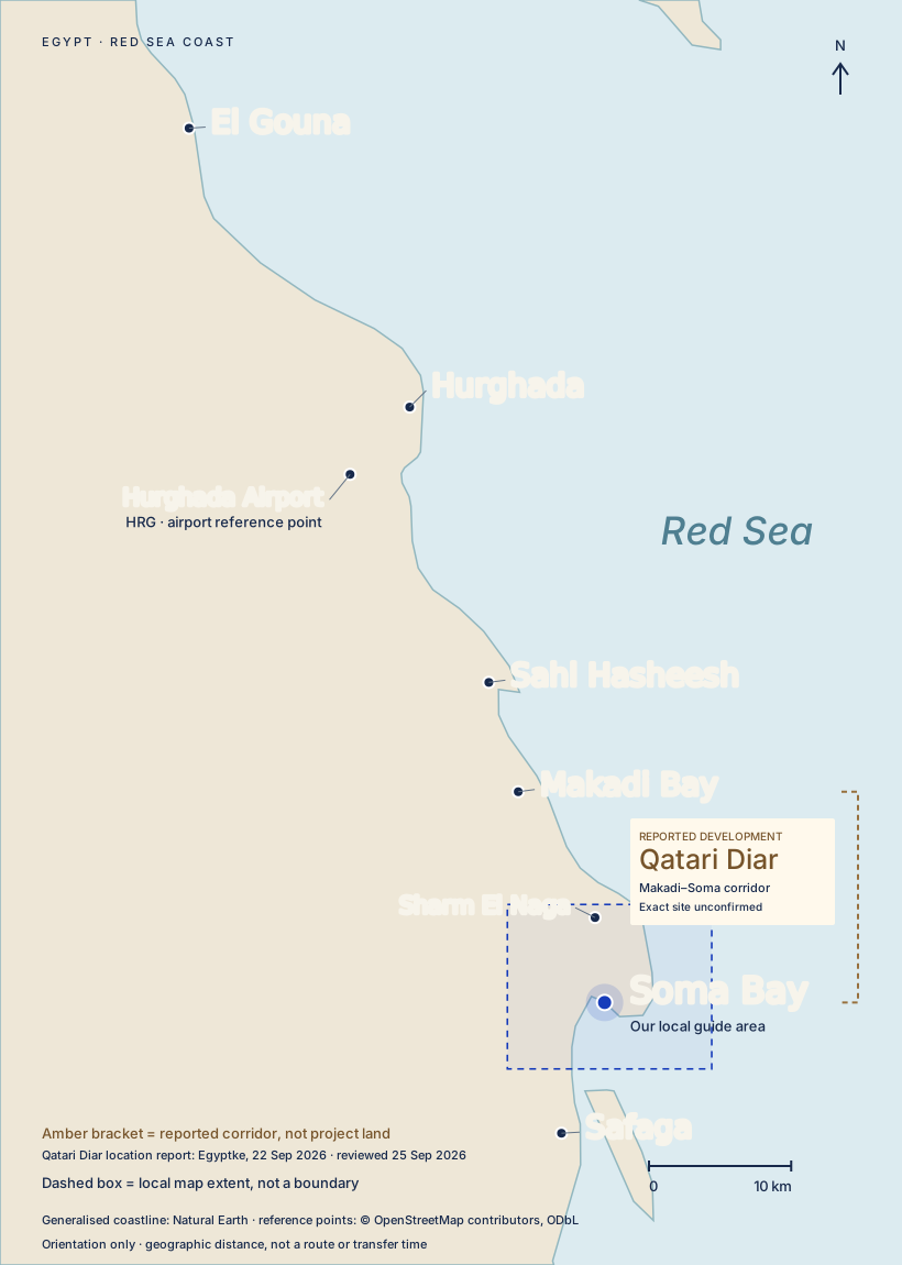
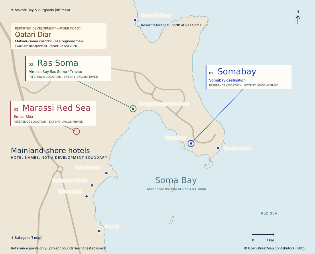
El Gouna to Safaga.
Hurghada, the airport, Sahl Hasheesh and Makadi Bay in relation to Soma Bay.
Open the regional map ↗03 / READ THE GROUND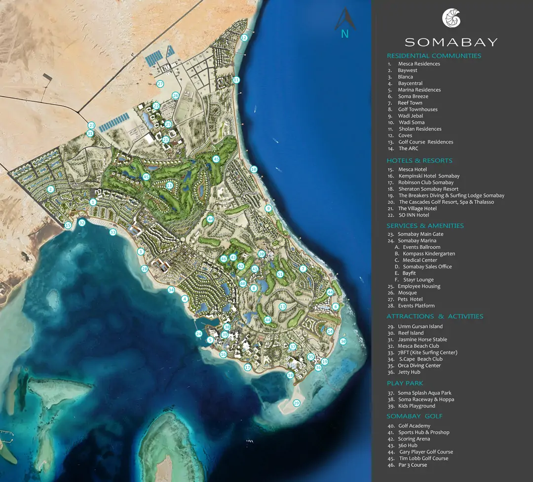
The satellite explorer.
Layer Somabay, Ras Soma, Marassi Red Sea, Makadi Heights and Makadina plans over imagery. Fade and share your view.
Open plans + satellite ↗BEFORE YOU READ A MAP
A location is not a boundary.
Orientation maps show where places sit along the coast. Pins locate places, not entrance gates or property boundaries. Straight-line distances are not driving times.
Masterplans show proposals. Their alignment over satellite imagery is approximate. A rendered marina, road or beach does not establish current construction or access.
Qatari Diar is reported between Makadi Bay and Soma Bay. The exact parcel is unconfirmed: we show no land polygon, entrance pin or distance to it.
Field notes & map companionsShore experiences, neighbourhoods, transport and offline editions
ORIGINAL FIELD NOTES / 01–03
Look closer.
Plan better.
New maps and practical tools
from Soma Bay Guide.
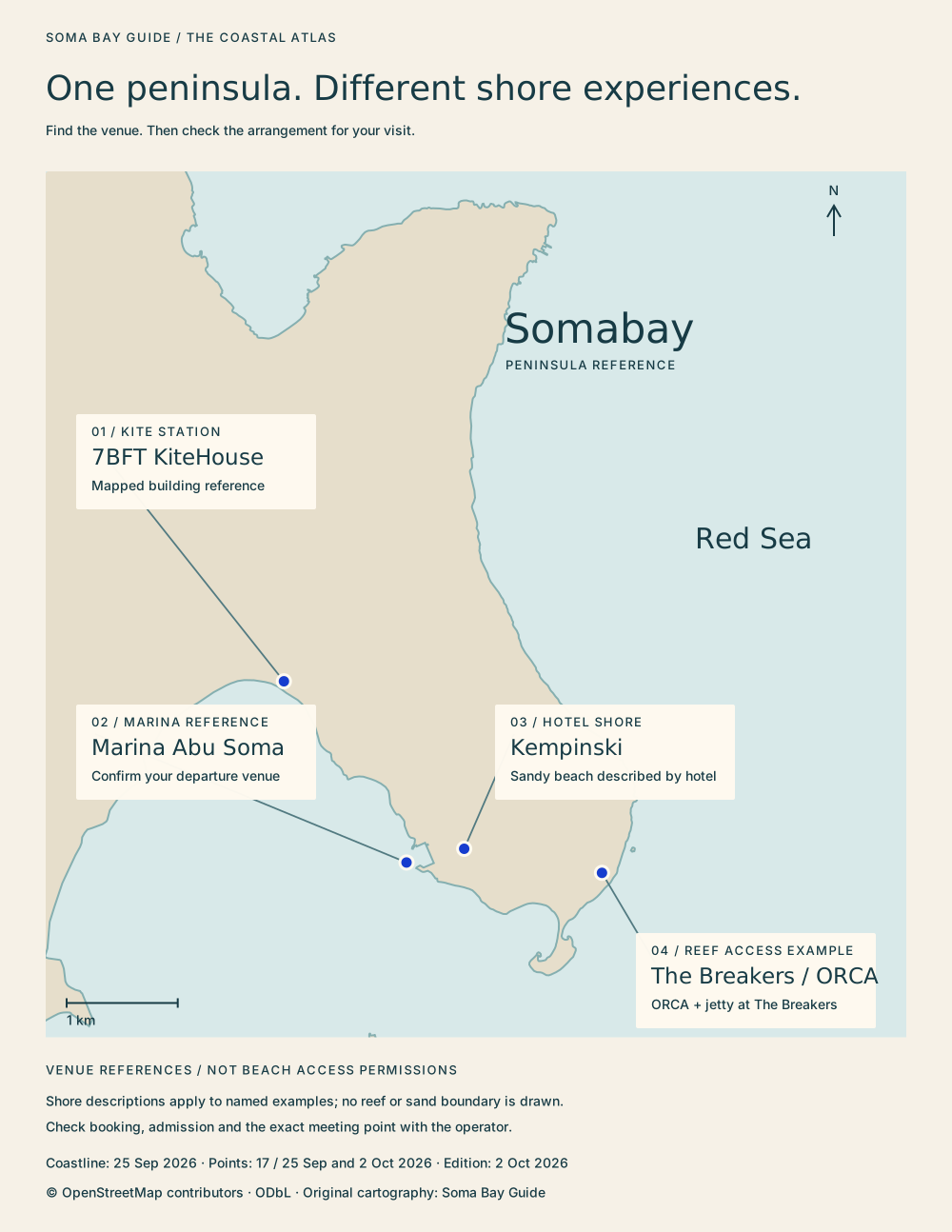
FIELD NOTE / 01
A sea view is only half the story.
Kite station, hotel beach, marina or reef: choose your activity, then agree the meeting point with the operator.
Read the shore atlas ↗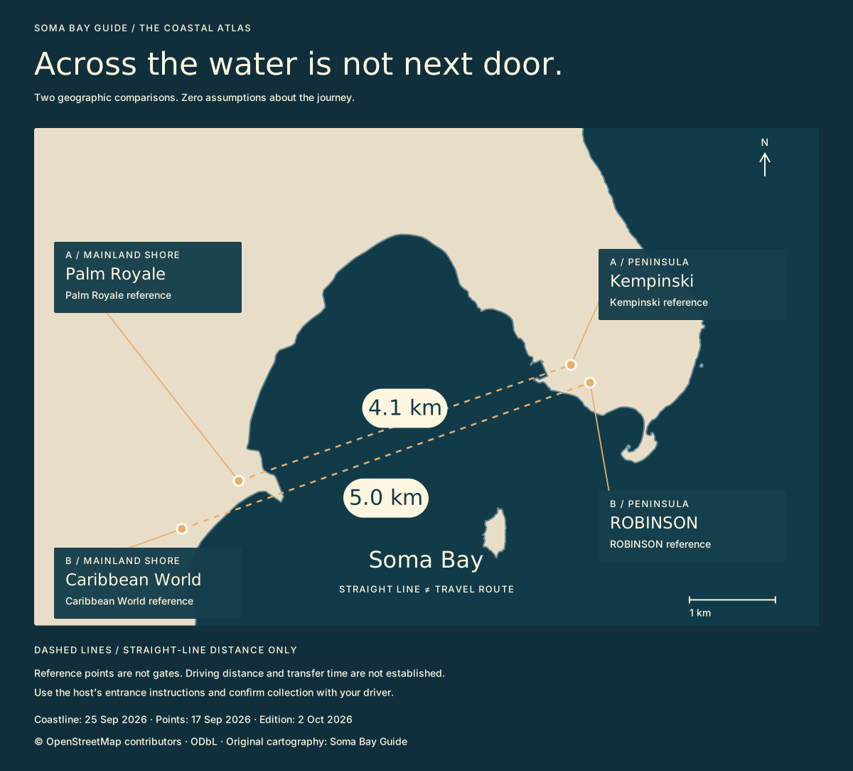
FIELD NOTE / 02
Across the water isn’t next door.
Two original geographic comparisons explain why a nearby-looking hotel still needs its own arrival plan.
Explore the bay comparisons ↗FIELD NOTE / 03
Is your home ready—or just tidy?
Ask for a dated condition report before you travel. Make your own blank report to print or save.
Prepare a condition report ↗Find your shore: plan a water day → · New town-errands map: Senzo, El Dahar and Safaga →