
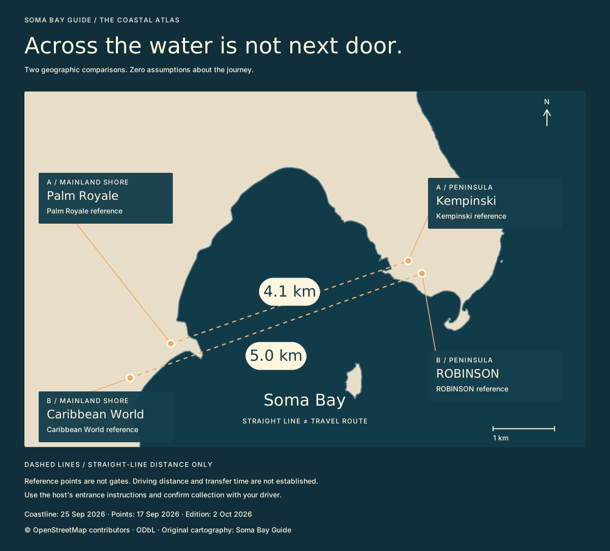
A distance is not an arrival plan.
Palm Royale and Caribbean World sit on the mainland shore; Kempinski and ROBINSON are peninsula references. The lines on this map connect those pairs directly. The figures describe their geographic separation, rounded to a tenth of a kilometre. They are not distances between reception desks or entrance gates.
If someone suggests meeting “at Soma Bay”, settle the hotel or venue first. Then ask for the host’s entrance instructions, whether any entry arrangement is needed, and where your driver should collect you afterwards. Do not use the across-water line to choose a walking route or assume a boat transfer exists.
Three details to put in the message.
The same distinction matters when comparing homes or hotels. A view towards another development does not establish shared facilities, entry rights or convenient access to it.
How we measured it.
We used the mapped coordinates in the source ledger and a great-circle calculation with an Earth radius of 6,371 km. The coastline is an OpenStreetMap extract retrieved on 25 September 2026; the hotel references were retrieved on 17 September. Processing them for this new illustration does not make the underlying observations newer.
Plan transport around the area → · Explore the rest of the atlas →
Sources, dates & limits
These are published-source checks, not direct operator confirmations. A retrieval date is not a publication date.
- OpenStreetMap coastline extract ↗
Source date not stated · Retrieved 2026-09-25 · Business confirmation: none
Saved orientation-data.geojson; coastline is not a cadastral boundary.
- OpenStreetMap hotel references ↗
Source date not stated · Retrieved 2026-09-17 · Business confirmation: none
Saved Nominatim results; building/feature reference points, not entrances.
Download source ledger and map reference points · OpenStreetMap attribution and licence