
YOUR FIRST LOOK
Get to know Soma Bay.
A coastal resort area on Egypt’s Red Sea, south of Hurghada. Start with where it is, then untangle the names before choosing a place to stay.
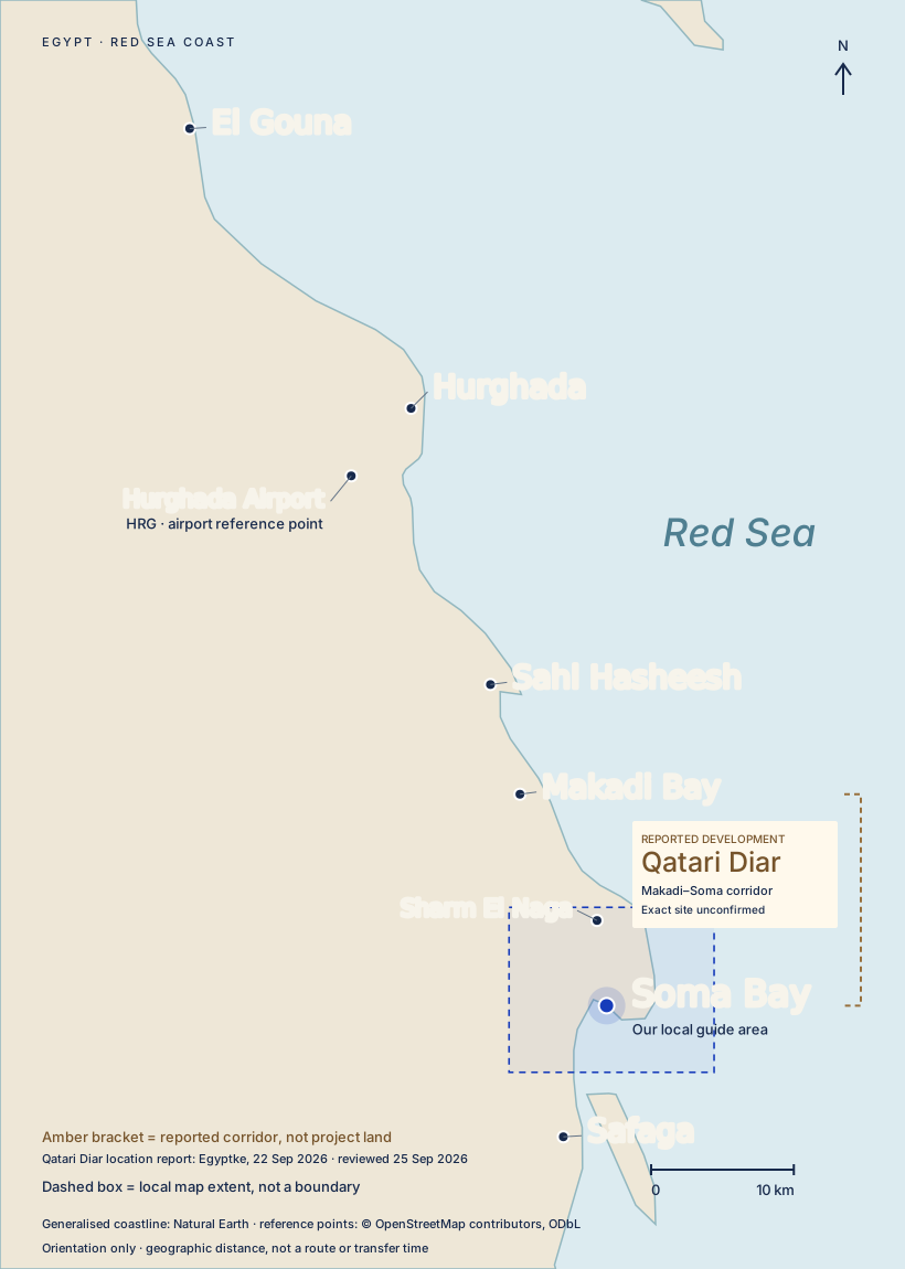 Open the wider-coast map ↗
A bay, a peninsula and a wider area.
“Soma Bay” is often used as a wider-area address. Somabay is the branded destination around the peninsula. Nearby resorts and developments have their own identities and arrival arrangements.
You will also see Almaza Bay Ras Soma, Travco’s separate development, and Marassi Red Sea, Emaar Misr’s Red Sea project. Neither name means the Somabay peninsula.
Read the names and their sources →Find it on the coast.
Use the regional map for the order of destinations from El Gouna to Safaga. Hurghada Airport has its own location; an airport pickup and a city pickup are different arrangements.
Understand your exact location.
Find the named hotel or development on the local map. A general “Soma Bay” address is not enough for a driver or a guest arriving at a home. Get the precise destination and entrance instructions from your host.
Then decide what you want from a stay.
Where you sleep, which beach or facility you can use and how you move around are separate questions. Read the access checklist before assuming a neighbouring hotel or development is included.
Looking at future developments?Satellite imagery, masterplans and what remains unknown
Masterplan layers are approximate proposals over satellite imagery, rather than surveyed ownership boundaries or proof of construction. Qatari Diar’s exact parcel remains unconfirmed.
Explore satellite and masterplans →What we know about Qatari Diar →Geography and project identities follow the existing Coast Explained chapters and map source notes.